
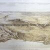
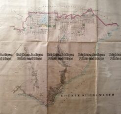
County of Heytesbury in Victoria by Bailliere c.1866
extracted from the very rare first atlas of Victoria. Great detail of sub-division of land.
Lithograph with hand colouring
78cm X 57cm
Condition A

$1,200.00
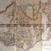
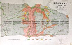
County of Heytesbury in Victoria by Bailliere c.1866
extracted from the very rare first atlas of Victoria. Great detail of sub-division of land.
Lithograph with hand colouring
78cm X 57cm
Condition A
You must be logged in to post a comment.
Reviews
There are no reviews yet.