CURRENCY
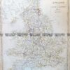
England (LAngleterre)
Dufour – circa 1856 Steel engraving 75cm X 55cm Condition A+
SOLD
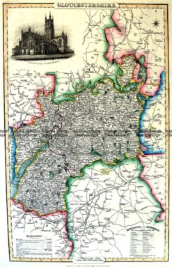
Antique Map 4-192 Gloucestershire by I. Slater c.1846
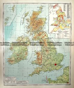
Antique Map 233-348 Groot Britannia en Ierland by Wolters c.1929
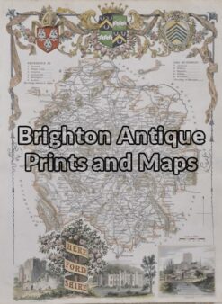
Antique Map 4-157 – England – Herefordshire Moule – circa 1840 Hand coloured steel engraving Condition A+
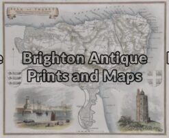
Antique Map 4-159 – England – Isle of Thanet Moule – circa 1840 Hand coloured steel engraving 26cm X 19cm Condition A+

 Dufour – circa 1856 Steel engraving 75cm X 55cm Condition A+")