CURRENCY
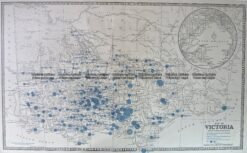
Victoria – Mallee District
Department of Lands & Survey – circa 1898 Hand coloured lithograph 61cm X 75cm Condition A+
Antique Print Antique Map 233-233 Gold Mines in Victoria – Ballarat and Bendigo c.1880’s
Antique Map 14-336 Victoria – showing State Schools c.1886
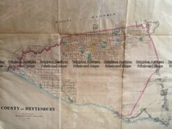
Antique Map 233-455 Victoria – County of Heytesbury by Bailliere c.1866
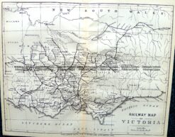
Antique Map 9-812 Victoria – Railway Map c.1896