CURRENCY
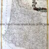
Tasmania – South East
Benard – circa 1777 Hand coloured copperplate engraving 35cm x 22cm Condition A
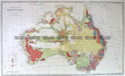
Antique Map 3-898 Australia Geological c.1886
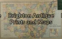
Antique Map 3-070 – New South Wales Picturesque Atlas – circa 1886 Chromolithograph 62cm X 38cm Condition A+
Antique Map 3-065 – New South Wales Picturesque Atlas – circa 1886 Chromolithograph 61cm X 37cm Condition A+
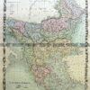
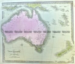
Antique Map 3-991 Australia and New Zealand c.1840