CURRENCY
$350.00
Australia in 1839 by S.D.U.K. c.1844
Steel engraving 39cm X 33cm yes,Condition A+
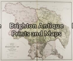
Antique Map 3-218 – Victoria – Counties of Moira, Delatite, Bogong & Wonnangatta John Sands – circa 1886 Chromolithograph 52cm X 42cm Condition A+
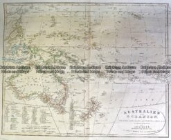
Antique Map 230-540 Australian oder Oceanien by Koehler c.1849
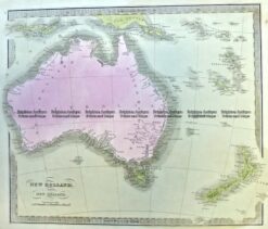
Antique Map 3-991 Australia and New Zealand c.1840
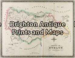
Antique Map 3-222 – Victoria – County of Evelyn F E Hiscock – circa 1874 Hand coloured lithograph 51cm X 40cm Condition A+