CURRENCY
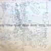
Victoria – Western coastline
Vandermaelen – circa 1827 Hand coloured engraving 57cm X 48cm Condition A+
SOLD
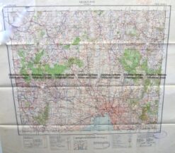
Antique Map 9-129 Military map of Melbourne c.1931
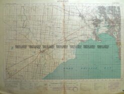
Antique Map 3-311 Victoria – Western suburbs of Melbourne c.1933
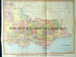
9-138 Victoria by Gordon & Gotch c.1880
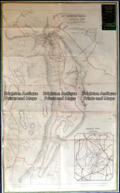
Antique map – Grampians Tourist Map c.1933 Ref: 889-022