CURRENCY
Bass Strait by Freycinet &;c.1811 (1812)
Cooperplate engraving 76cm X 49cm Condition A washed lightly
SOLD
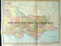
9-138 Victoria by Gordon & Gotch c.1880
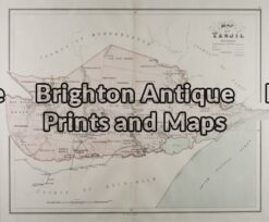
Antique Map 14-205 – Victoria – Tanjil J Sands – circa 1886 Chromolithograph 53cm X 43cm Condition A+
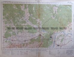
Antique Map 3-303 Victoria – Moe area c.1940
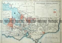
Antique Map – Victorian Water Supply c.1890 Ref No. 238-002


")