CURRENCY
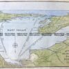
Bass Strait by Freycinet &;c.1811 (1812)
Cooperplate engraving 76cm X 49cm Condition A washed lightly
SOLD
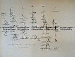
Antique Print Antique Map 233-234 Gold Mines in Victoria – Ballarat and Bendigo c.1880’s
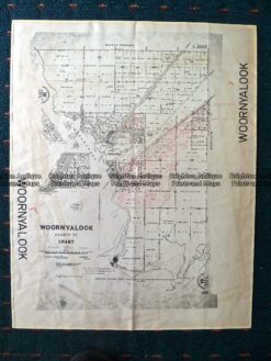
Antique Map 230-507 Woornyalook parish map c. 1940
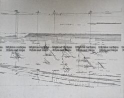
Antique Map 236-044 Gold mining – cross-sections of mines in Sandhurst (Bendigo)
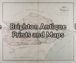
Antique Map 14-205 – Victoria – Tanjil J Sands – circa 1886 Chromolithograph 53cm X 43cm Condition A+

")