CURRENCY
World
Neale – circa 1810 Hand coloured steel engraving 37cm X 24cm Condition B
SOLD
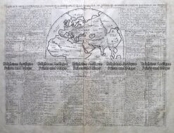
Antique Map 232-152 Eastern Hemisphere by Chatelain c.1719
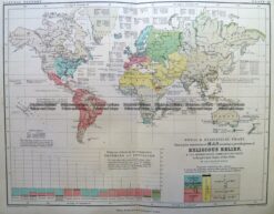
Antique Map 232-574 World – Religions by Bartholomew c.1900
Antique Map 3-389 World – Religious Belief c.1851
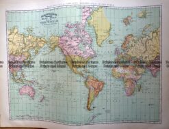
Antique Map 233-017 World on Mercator projection by Rand McNally c.1894