CURRENCY
$165.00
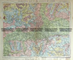
London Railway Map by Gordon & Gotch c.1880
Lithograph 35cm X 27cm Condition A
There are no reviews yet.
You must be logged in to post a comment.
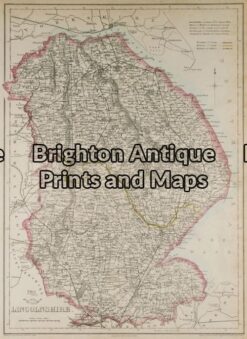
Antique Map 5-144 – England – Lincolnshire J Dower – circa 1850 Steel engraving 31cm X 43cm Condition A+
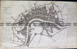
Antique Map 232-145 London by Harrison c.1775
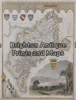
Antique Map 5-162 – England – Cumberland Moule – circa 1940 Hand coloured steel engraving 19cm X 26cm Condition A+
Antique Map 233-361 Environs of London by Letts c.1880


Reviews
There are no reviews yet.