CURRENCY
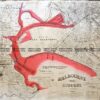
Melbourne bird’s eye view by John Power -1935 centenary c.1935
Chromolithograph 96cm X 71cm Condition A+
Nicely framed
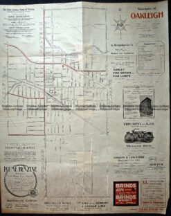
Antique Map 3-222 Oakleigh originally c.1920
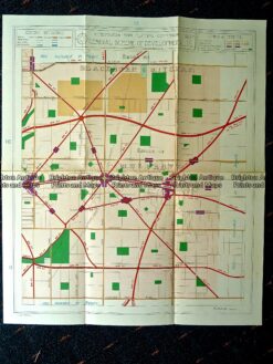
Antique map – Street map of Mulgrave, Melbourne c.1929 Ref# 232-874
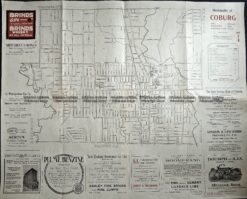
Antique Map 3-221 Coburg street map c.1920
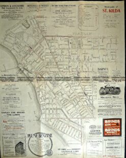
Antique Map 9-162 St Kilda street map c.1920