CURRENCY
$480.00
Tasmania
Johnston – circa 1845Steel engraving49cm X 59cmCondition A+
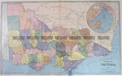
Antique Map 3-203 – Victoria Picturesque Atlas circ 1886 Chromolithograph 61cm X 37cm Condition A+
Antique Map 3-070 – New South Wales Picturesque Atlas – circa 1886 Chromolithograph 62cm X 38cm Condition A+
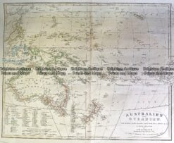
Antique Map 230-540 Australian oder Oceanien by Koehler c.1849
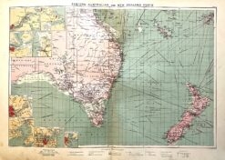
Antique map – Eastern Australia & New Zealand c.1913. Ref: 339-029