CURRENCY
Tasmania – South East
Benard – circa 1777 Hand coloured copperplate engraving 35cm x 22cm Condition A
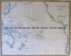
Antique Map 3-869 Pacific by S.D.U.K c.1844
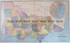
Antique Map 3-203 – Victoria Picturesque Atlas circ 1886 Chromolithograph 61cm X 37cm Condition A+
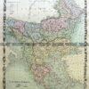
Antique Map 3-066 – New South Wales – Botany Bay Queensland – Endeavour River Pair of maps from Cooks 1st voyage – circa 1774 French Edition Copperplate engraving 33cm X 13cm Condition A+
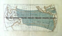
Antique Map 3-006 – Australia – Mer du Sud (Pacific) A F Prevost – circa 1753 Hand coloured copperplate engraving 30cm X 15cm Condition A+