CURRENCY
Victoria -Port Phillip to Gabo Island
Navigation Chart – circa 1945 Steel engraving 99cm X 67cm Condition A
&;
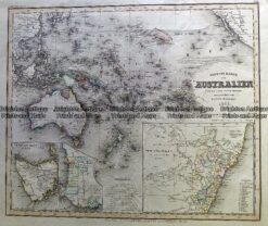
Antique Map 230-542 Neueste Karte von Australien by Radefeld c.1846
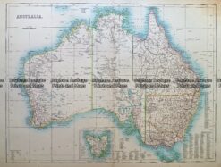
Antique Map 232- 268 Australia c.1890
Antique Map 3-066 – New South Wales – Botany Bay Queensland – Endeavour River Pair of maps from Cooks 1st voyage – circa 1774 French Edition Copperplate engraving 33cm X 13cm Condition A+
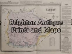
Antique Map 3-806 County of Camden NSW by Basch circa 1872