CURRENCY
$290.00
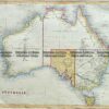
Australia by Johnson &;c.1855
Johnson – circa 1861 Hand coloured steel engraving 40cm X 32cm Condition A
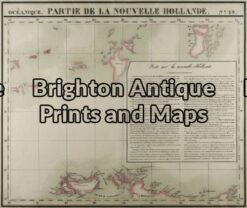
Antique Map 3-101 – Northern Territory Vandermaelen – circa 1827 Hand coloured steel engraving 56cm X 47cm Condition A+
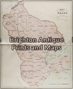
Antique Map 3-215 – Victoria – County of Grant John Sands – circa 1886 Chromolithograph 43cm X 53cm Condition A+
Antique Map 3-064 – New South Wales Picturesque Atlas – circa 1886 Chromolithograph 61cm X 37cm Condition A+
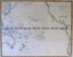
Antique Map 3-869 Pacific by S.D.U.K c.1844