CURRENCY
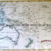
Polynesia
John Tallis – circa 1851 Steel engraving 33cm X 26cm Condition A+
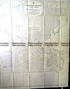
Antique Print Antique Map 230-602 Australia and Asia – Indian Ocean shipping routes c.1950
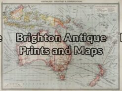
Antique Map 3-003 – Australia: Industries & Communications George Philip – circa 1905 Chromolithograph 48cm X 35cm Condition A+
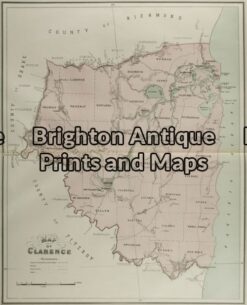
Antique Map 3-068 – New South Wales – Clarence John Sands – circa 1886 Chromolithograph 42cm X 53cm Condition A+
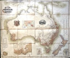
Antique map – Australia c.1857. Ref: 339-016