CURRENCY
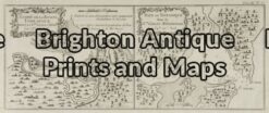
3-811 Geological map of Western Port showing coalfields
Coloured lithograph 54cm X 40cm Condition A+
SOLD
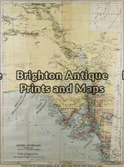
Antique Map 3-080 – South Australia Australian Handbook – circa 1885 Chromolithograph 38cm X 51cm Condition A
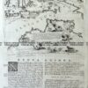
Antique Map 3-066 – New South Wales – Botany Bay Queensland – Endeavour River Pair of maps from Cooks 1st voyage – circa 1774 French Edition Copperplate engraving 33cm X 13cm Condition A+
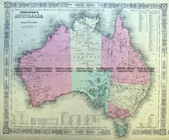
Antique Map 3-987 Australia by Johnson & Ward c.1859
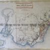
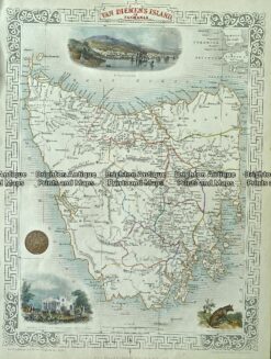
Antique Map 3-086 – Tasmania J Tallis – circa 1851 26cm X 36cm Condition A+