CURRENCY
Pakenham street map in Parish of Pakenham &;c.1948
Lithograph 50cm X 50cm Condition
Antique Map Carngham / Grenville 1937
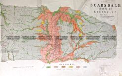
Antique Map 236-019 Geological map of Scarsdale in Victoria c.1889
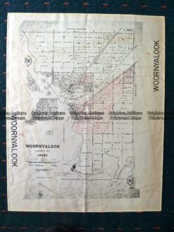
Antique Map 230-507 Woornyalook parish map c. 1940
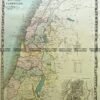
Antique Map 14-218 – Victoria – Counties of Moira, Delatite & Bogong John Sands – circa 1886 Chromolithograph 52cm X 42cm Condition A+