CURRENCY
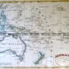
New Holland and New Zealand by C. Smith c.1835
Hand coloured steel engraving 36cm X 27cm Condition A+
SOLD
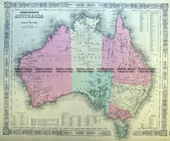
Antique Map 3-987 Australia by Johnson & Ward c.1859
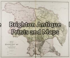
Antique Map 3-218 – Victoria – Counties of Moira, Delatite, Bogong & Wonnangatta John Sands – circa 1886 Chromolithograph 52cm X 42cm Condition A+
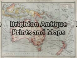
Antique Map 3-003 – Australia: Industries & Communications George Philip – circa 1905 Chromolithograph 48cm X 35cm Condition A+
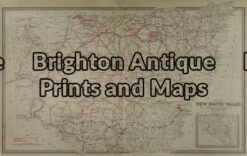
Antique Map 3-065 – New South Wales Picturesque Atlas – circa 1886 Chromolithograph 61cm X 37cm Condition A+