CURRENCY
England (LAngleterre)
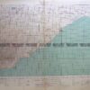
Dufour – circa 1856 Steel engraving 75cm X 55cm Condition A+
SOLD
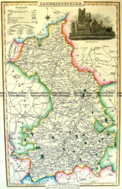
Antique Map 4-194 Cambridgeshire by I. Slater c.1846
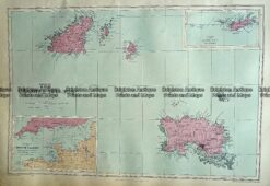
Antique Map 233-310 Channel Islands by Stanford c.1879
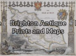
Antique Map 4-158 – England – Isle of Man Moule – circa 1840 Hand coloured steel engraving 26cm X 19cm Condition A+
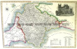
Antique Map 4-189 Devonshire England by I. Slater c.1846


 Dufour – circa 1856 Steel engraving 75cm X 55cm Condition A+")