CURRENCY
$240.00
England – Hampshire
Moule – circa 1840 Hand coloured steel engraving 21cm X 26cm Condition A+
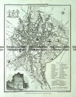
Antique map – Norwich Street Map by Verner, Hood & Sharpe c.1805 Ref#232-745
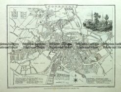
Antique map – Coventry Street Map by Verner, Hood & Sharpe c.1805 Ref#232-721
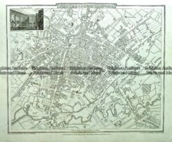
Antique map – Manchester & Salford Street Map by Verner, Hood & Sharpe c.1805 Ref#232-744
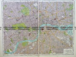
Antique map – London street map by Harmsworth c.1920 Ref# 232-917