CURRENCY
$350.00
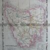
Ireland by S.D.U.K. c.1844
Steel engraving 38cm X 62cm Condition A+
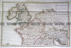
Antique Map 232-148 L’Empire Romain by D’Anville c.1797
Antique Map 4-185 Dublin panorama c.1874
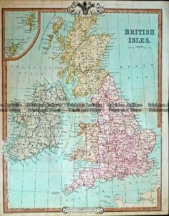
Antique Map 232-402 Britain by Cruchley c.1834
Antique Map 4-146 – England – Hampshire Moule – circa 1840 Hand coloured steel engraving 21cm X 26cm Condition A+