Brighton Antique Prints and Maps
Currency
WOOCS 2.1.5
VIEW CART
  • CURRENCY

    WOOCS 2.1.5
  • Home
  • Catalogue
    • Antique Maps
    • Antique Prints
    • Books & Gov’t Reports
    • Manuscript Documents
  • Recent Arrivals
  • About
  • FAQ
  • Register Interests
  • Contact Us
5-030 – Mediterranean Sea Thomson – circa 1817 Outline colour engraving 60cm X 49cm Condition B+

Home/Antique Maps/Europe/Europe - Continent

Antique Map 5-030 – Mediterranean Sea Thomson – circa 1817 Outline colour engraving 60cm X 49cm Condition B+

SKU: 5-030 Categories: Antique Maps, Europe - Continent
16-233 - World Neale - circa 1810 Hand coloured steel engraving 37cm X 24cm Condition B
3-307  Victoria - Anglesea area  c.1926
  • Description

Mediterranean Sea

Thomson – circa 1817
Outline colour engraving
60cm X 49cm
Condition B+

SOLD


These may also be of interest

  • Antique Maps

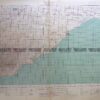
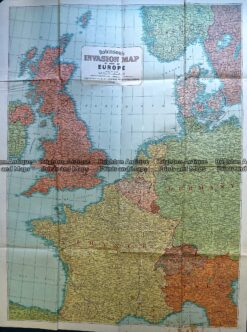
    Antique Map 230-197 Europe – World War II invasion map c.1940’s

    $125.00
  • 5-029 - Europe - at the times of Charles V Jenotte - circa 1830 Hand coloured steel engraving 43cm X 29cm Condition A+
    Antique Maps

    Antique Map 5-029 – Europe – at the times of Charles V Jenotte – circa 1830 Hand coloured steel engraving 43cm X 29cm Condition A+

    $90.00
  • 5-024 - Europe - ethnographic map W & AK Johnston - circa 1860 Hand coloured steel engraving 59cm X 49cm Condition B
    Antique Maps

    Antique Map 5-024 – Europe – ethnographic map W & AK Johnston – circa 1860 Hand coloured steel engraving 59cm X 49cm Condition B

    $150.00
  • Antique Maps

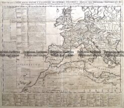
    Antique Map 232-174 Europe in Roman times by Chatelain c.1719

    $350.00
© 2026 BRIGHTON ANTIQUE PRINTS AND MAPS. ALL RIGHTS RESERVED | Website by Blaze Online
Credit Card
Norton Safe Web Transaction
  • Home
  • Catalogue
    • Antique Maps
    • Antique Prints
    • Books & Gov’t Reports
    • Manuscript Documents
  • Recent Arrivals
  • About
  • FAQ
  • Register Interests
  • Contact Us
  • View Cart
  • Login
  • Currency
    WOOCS 2.1.5

Sending...