CURRENCY
Denmark
Vander Aa – circa 1725 Copperplate engraving 36cm X 29cm Condition A+
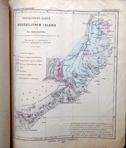
Antique map – Iceland by Perthes c.1895. Reference 290-001
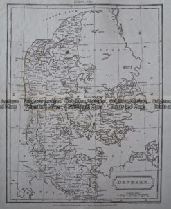
Antique Map – Denmark by Walker c.1805 Ref: 237- 351
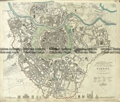
Antique Map 233-014 Street Map of Vienna Austria by S.D.U.K. c.1844
Antique Map