CURRENCY
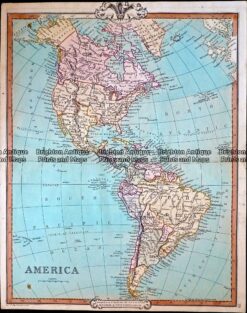
Western Hemisphere – North & South America&;&;by Teesdale &;c.1844
Hand coloured steel engraving 41cm X 33cm Condition A+
Antique Map 12-191 – South America W & R Chambers – circa 1840 Steel engraving 20cm X 26cm Condition A+
Antique Map 232-422 Western Hemisphere by Cruchley c.1834
Antique Map 12-201 Panama by Tallis circa 1851
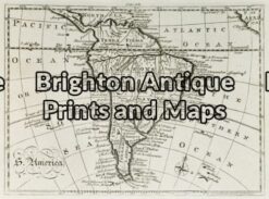
Antique Map 12-195 – South America A Bell – circa 1775 Copperplate engraving 20cm X 14cm Condition A+