CURRENCY
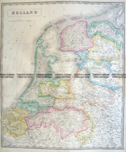
Holland and Belgium by Colton c1855
Hand coloured steel engraving 32cm X 40cm Condition
SOLD
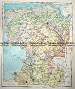
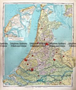
Antique Map 233-346 Holland – Groningen, Friesland, Drente en Overijsel by Wolters c.1929
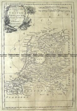
Antique Map 5-169 Holland or United Provinces by Gibson c.1771
Antique Map 233-343 Holland – noord en Zuid en Utrecht by Wolters c.1929
Antique Map 5-157 Holland by J Wyld c.1840