CURRENCY
Oost Zee sea chart by Jansson / van Loon c.1655
Copperplate engraving 54cm X 42cm Condition A
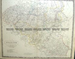
Antique Map 5-160 Belgium by Johnston c.1857
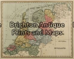
Antique Map 5-051 – Holland by J Wyld – circa 1820
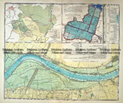
Antique Map 233- 340 Holland – Oosterbeek by Wolters c.1929
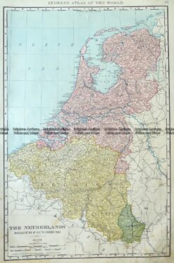
Antique Map 5-162 The Netherlands Belgium & Luxemburg by Rand McNally c.1890