CURRENCY
$150.00
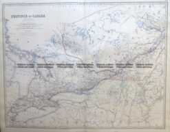
Canada – Ontario and Quebec by Johnston &;c.1864
Steel engraving 57cm X 44cm Condition A
Antique Map 8-197 Canada – Ontario and Quebec by Johnston c.1964
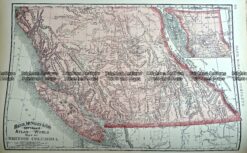
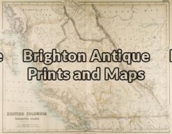
Antique Map 233-256 British Columbia Canada by Rand McNally c.1894
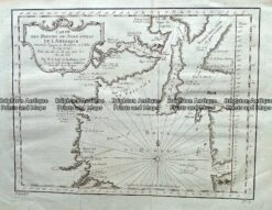
Antique Map 232-168 Carte des Parties du Nord Ouest de L’Amerique by Bellin c.1753
Antique Map 8-185 – Canada – British Columbia J Bartholomew – circa 1854 Steel engraving 54cm X 42cm Condition A+