CURRENCY
$125.00
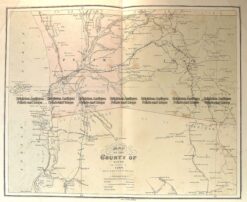
Railway map of South Australia &;c.1896
Lithograph 22cm X 23cm Condition A+
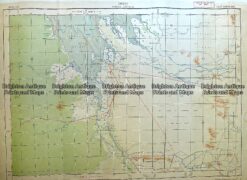
Antique Map 230-614 Western Australia -military maps c.1940’s
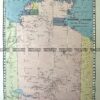
Antique Map 15-114 Western Australia – Perth and vicinity c.1886
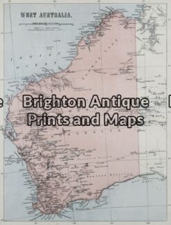
Antique Map 15-099 – Western Australia John Sands – circa 1886 Chromolithograph 42cm X 52cm Condition A+
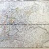
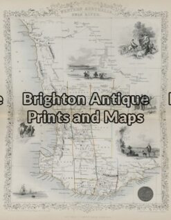
Antique Map 15-098 – Western Australia J Tallis – circa 1851 Steel engraving 26cm X 36cm Condition A+