CURRENCY
$240.00
England – Isle of Thanet
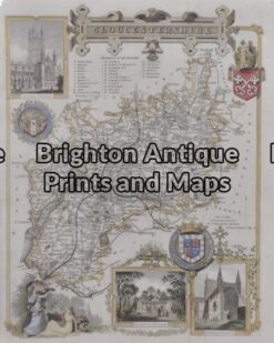
Antique Map 5 – 163 – England – Gloucestershire Moule – circa 1840 Hand coloured steel engraving 19cm X 26cm Condition A+
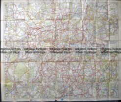
Antique map – RAC map of London c.1930’s
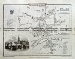
Antique map – Bedford Street Map by Verner, Hood & Sharpe c.1805 Ref# 232-716
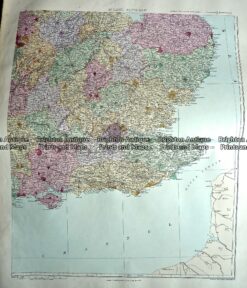
Antique Map 233-293 England – South East England by Stanford c.1887