Brighton Antique Prints and Maps
Currency
WOOCS 2.1.5
VIEW CART
  • CURRENCY

    WOOCS 2.1.5
  • Home
  • Catalogue
    • Antique Maps
    • Antique Prints
    • Books & Gov’t Reports
    • Manuscript Documents
  • Recent Arrivals
  • About
  • FAQ
  • Register Interests
  • Contact Us
2-158  Tallis map of Tibet and Mongolia

Home/Antique Maps/Asia/China & Japan & Korea

Antique Map 2-158 Tallis map of Tibet and Mongolia

$290.00

SKU: 2-158 Categories: Antique Maps, China & Japan & Korea, Other
16-260  World - Admiralty chart - Wind chart  c.1879
  • Description

Asia – Tibet and Mongolia

J Tallis – circa 1851
Steel engraving
Condition A+


These may also be of interest

  • 2-141 - Japan - Japanese map Anon  - circa 1890 Wood block 60cm X 50cm Condition A
    Antique Maps

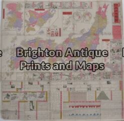
    Antique Map 2-141 – Japan – Japanese map Anon – circa 1890 Wood block 60cm X 50cm Condition A

    $500.00
  • 2-136 - Afghanistan - Cabool Tallis - circa 1851 Steel engraving 32cm X 24cm Condition A+
    Antique Maps

    Antique Map 2-136 – Afghanistan – Cabool Tallis – circa 1851 Steel engraving 32cm X 24cm Condition A+

    $280.00
  • 2-119 - Asia - Japan G Philip - circa 1905 Chromolithograph 35cm X 48cm Condition A+
    Antique Maps

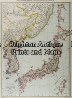
    Antique Map 2-119 – Asia – Japan G Philip – circa 1905 Chromolithograph 35cm X 48cm Condition A+

    $130.00
  • Antique Maps

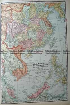
    Antique Map 233-248 China, Indo China and Malaysia by Rand McNally c.1894

    $125.00
© 2026 BRIGHTON ANTIQUE PRINTS AND MAPS. ALL RIGHTS RESERVED | Website by Blaze Online
Credit Card
Norton Safe Web Transaction
  • Home
  • Catalogue
    • Antique Maps
    • Antique Prints
    • Books & Gov’t Reports
    • Manuscript Documents
  • Recent Arrivals
  • About
  • FAQ
  • Register Interests
  • Contact Us
  • View Cart
  • Login
  • Currency
    WOOCS 2.1.5

Sending...