Brighton Antique Prints and Maps
Currency
WOOCS 2.1.5
VIEW CART
  • CURRENCY

    WOOCS 2.1.5
  • Home
  • Catalogue
    • Antique Maps
    • Antique Prints
    • Books & Gov’t Reports
    • Manuscript Documents
  • Recent Arrivals
  • About
  • FAQ
  • Register Interests
  • Contact Us
8-813 Proposed improvements in River Yarra by Coode circa 1879

Home/Antique Maps/Australia & Pacific/Australia - Continent

Antique Map 8-813 Proposed improvements in River Yarra by Coode circa 1879

SKU: 8-813 Categories: Antique Maps, Australia - Continent
3-805 County of Cumberland NSW by Basch circa 1872
3-022 - Australia - East Coast of Australia from Cooks first voyage Dutch edition van Baasel - circa 1774 Copperplate engraving with outline colour 78cm X 36cm Condition A+
  • Description

8-813 Plan of proposed docks in Yarra River

Lithograph
120cm X 50cm
Condition A+

SOLD


These may also be of interest

  • 14-336  Victoria - showing State Schools  c.1886
    Antique Maps

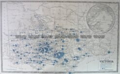
    Antique Map 14-336 Victoria – showing State Schools c.1886

    $225.00
  • Australia - Continent

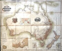
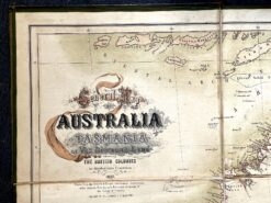
    Antique map – Australia c.1857. Ref: 339-016

    $2,600.00
  • 3-070 - New South Wales Picturesque Atlas - circa 1886 Chromolithograph 62cm X 38cm Condition A+
    Antique Maps

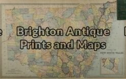
    Antique Map 3-070 – New South Wales Picturesque Atlas – circa 1886 Chromolithograph 62cm X 38cm Condition A+

    $175.00
  • 3-068 - New South Wales - Clarence John Sands - circa 1886 Chromolithograph 42cm X 53cm Condition A+
    Antique Maps

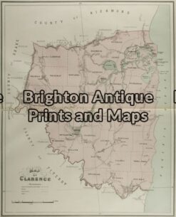
    Antique Map 3-068 – New South Wales – Clarence John Sands – circa 1886 Chromolithograph 42cm X 53cm Condition A+

    $190.00
© 2026 BRIGHTON ANTIQUE PRINTS AND MAPS. ALL RIGHTS RESERVED | Website by Blaze Online
Credit Card
Norton Safe Web Transaction
  • Home
  • Catalogue
    • Antique Maps
    • Antique Prints
    • Books & Gov’t Reports
    • Manuscript Documents
  • Recent Arrivals
  • About
  • FAQ
  • Register Interests
  • Contact Us
  • View Cart
  • Login
  • Currency
    WOOCS 2.1.5

Sending...