CURRENCY
Victoria & Bass Strait
Vandermaelen – circa 1827 Hand coloured steel engraving 56cm X 47cm Condition A+
SOLD
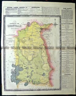
Antique Map 14-229 – County of Grenville Hiscock – circa 1874 Hand coloured lithograph 41cm X 49cm Condition A+
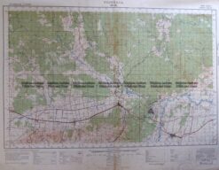
Antique Map 3-303 Victoria – Moe area c.1940
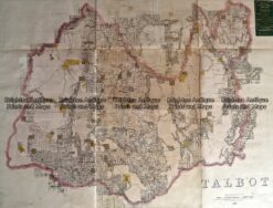
Antique Map 233-454 Victoria – County of Talbot by Bailliere c.1866
Antique Map 3-830 Doutta Galla in County of Bourke c.1969