CURRENCY
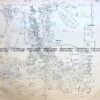
Victoria – Portland district
Admiralty Chart – circa 1835 Steel engraving 46cm X 63cm Condition A+
SOLD
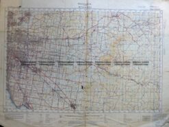
Antique Map 3-304 Victoria – Ringwood area c.1935
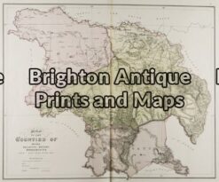
Antique Map 14-218 – Victoria – Counties of Moira, Delatite & Bogong John Sands – circa 1886 Chromolithograph 52cm X 42cm Condition A+
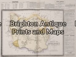
Antique Map 14-230 – County of Anglesey Hiscock – circa 1874 Hand coloured lithograph 51cm X 39cm Condition A+
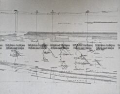
Antique Map 236-044 Gold mining – cross-sections of mines in Sandhurst (Bendigo)