
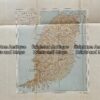
Military map of Holland (Netherland), Prussia and Belgium c.1910
Chromolithograph
41cm X 40cm
Condition A

$75.00
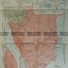
Military map of Holland (Netherland), Prussia and Belgium c.1910
Chromolithograph
41cm X 40cm
Condition A
You must be logged in to post a comment.


Reviews
There are no reviews yet.