

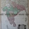
India by Charles Smith c.1822
two sheet map
Hand coloured copperplate engraving
54cm X 70
Condition A

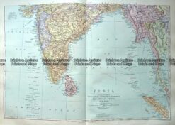
India by Charles Smith c.1822
two sheet map
Hand coloured copperplate engraving
54cm X 70
Condition A
You must be logged in to post a comment.

Reviews
There are no reviews yet.