CURRENCY
$275.00
Victoria – Railways and stations c.1886
Chromolithograph 78cm X 59cm Condition A
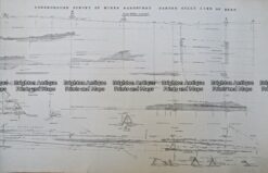
Antique Print Antique Map 233-237 Gold Mines in Victoria – Ballarat and Bendigo c.1880’s
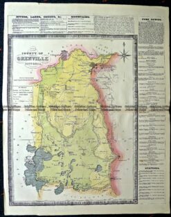
Antique Map 14-229 – County of Grenville Hiscock – circa 1874 Hand coloured lithograph 41cm X 49cm Condition A+
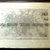
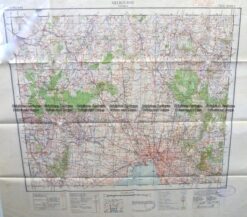
Antique Map 9-129 Military map of Melbourne c.1931
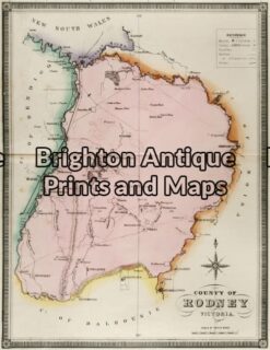
Antique Map 14-220 – Victoria – County of Rodney F E Hiscock – circa 1874 Hand coloured lithograph 42cm X 49cm Condition A+