CURRENCY
3-800 &;Australia and East Indies
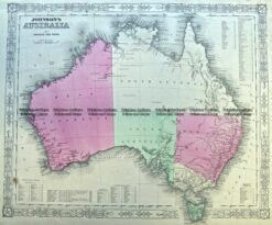
Johnson &;circa 1860 Hand coloured steel engraving 43cm X 58cm Condition A+
SOLD
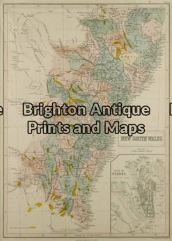
Antique Map 3-073 – New South Wales J Bartholomew circa 1848 Hand coloured steel engraving 27cm X 38cm Condition A+
Antique Map 230-542 Neueste Karte von Australien by Radefeld c.1846
Antique Map 3-988 Australia by Johnson & Ward c.1855
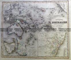
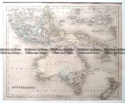
Antique Map – Australia & New Zealand by Betts c.1845 Ref: 237-360