CURRENCY
Hand coloured lithograph 52cm X 38cm Condition A+
$425.00
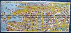
Antique Map 230-505 Sydney street map c.1960
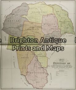
Antique Map 9-069 – New South Wales Benarba, Stapylton, Courallie, etc J Sands – circa 1886 Chromolithograph 42cm X 53cm Condition A+
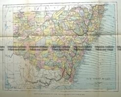
Antique Map 232-091 New South Wales by Gordon & Gotch c.1889
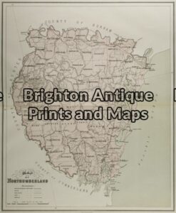
Antique Map 9-067 – New South Wales Northumberland J Sands – circa 1886 Chromolithograph 42cm X 53cm Condition A+