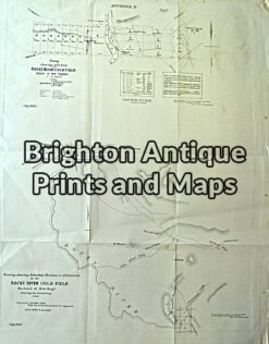
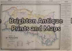
Brighton Antique Prints and Maps
Currency
WOOCS 2.1.5
VIEW CART
  • CURRENCY

    WOOCS 2.1.5
  • Home
  • Catalogue
    • Antique Maps
    • Antique Prints
    • Books & Gov’t Reports
    • Manuscript Documents
  • Recent Arrivals
  • About
  • FAQ
  • Register Interests
  • Contact Us
3-808 County of Roxburgh by Basch circa 1872

Home/Antique Maps/Australia & Pacific/NSW

Antique Map 3-808 County of Roxburgh by Basch circa 1872

SKU: 3-808-2 Categories: Antique Maps, NSW
13-95  Tasmania - Navigation Chart of Banks Strait  c.1878 (1921)
3-870  New South Wales and South Australia c.1845
  • Description
3-808 &;County of Roxburgh NSW from the first atlas printed in Australia

Hand coloured lithograph
52cm X 38cm
Condition A+

$425.00


These may also be of interest

  • Antique Maps

    Antique Map 230-818 Gold Field map of Rocky River c.1860

    $125.00
  • 9-074 - New South Wales & Tasmania G Philip - circa 1859 Hand coloured steel engraving 60cm X 52cm Condition A+
    Antique Maps

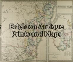
    Antique Map 9-074 – New South Wales & Tasmania G Philip – circa 1859 Hand coloured steel engraving 60cm X 52cm Condition A+

    $390.00
  • Antique Maps

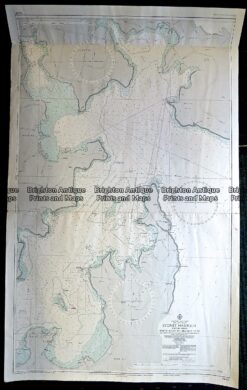
    Antique Print Antique Map 230-529 Sydney Harbour Navigation Chart

    $250.00
  • 3-805 Map of County of Cumberland by Basch circa 1872
    Antique Maps

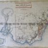
    Antique Map 3-805 Map of County of Cumberland by Basch circa 1872

    $850.00
© 2025 BRIGHTON ANTIQUE PRINTS AND MAPS. ALL RIGHTS RESERVED | Website by Blaze Online
Credit Card
Norton Safe Web Transaction
  • Home
  • Catalogue
    • Antique Maps
    • Antique Prints
    • Books & Gov’t Reports
    • Manuscript Documents
  • Recent Arrivals
  • About
  • FAQ
  • Register Interests
  • Contact Us
  • View Cart
  • Login
  • Currency
    WOOCS 2.1.5
Brought to you by WisdmLabs: WordPress Development Experts

Sending...