CURRENCY
Mediterranean Sea
Thomson – circa 1817 Outline colour engraving 60cm X 49cm Condition B+
SOLD
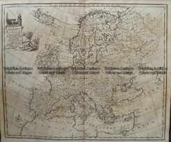
Antique Map 232-070 Europe by Bowen c.1744
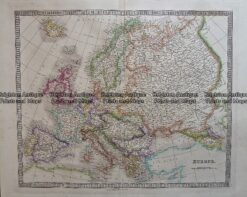
5-027 – Europe at Napoleonic era W & AK Johnston – circa 1886 Chromolithograph 43cm X 30cm Condition A+
Antique Map 232-401 Europe by Cruchley c.1834
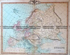
Antique Map 5-070 Europe by Teasdale c.1847