CURRENCY
$225.00
Street map of Paris &;c.1949
Chromolithograph 72cm X 52cm Condition B (repaired tears along folds) &;
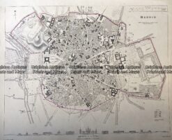
Antique Map 233-006 Madrid Street Map Spain by S.D.U.K. c.1844
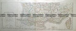
Antique Map 232-170 Carte de la Republique Française by Chanlaire c.1780
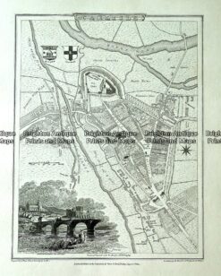
Antique map – Carlisle street map by Verner, Hood & Sharpe c.1805 Ref# 232-719
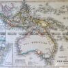
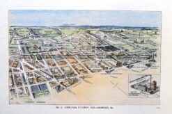
Antique Print Antique Map 29-491 Carlton, Fitzroy and Collingwood c.1906