CURRENCY
$160.00
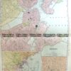
Boston street map by S.D.U.K. c.1844
Steel engraving 30cm X 37cm Condition A
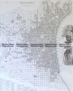
8-198 Philadelphia street map by S.D.U.K. c.1844
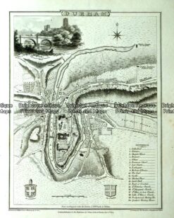
Antique map -Durham Street Map by Verner, Hood & Sharpe c.1805 Ref#232-738
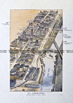
Antique Print Antique Map 29-488 Flinders Street bird’s eye view c.1906
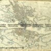
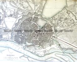
Antique Map 5-180 Hamburg street map by S.D.U.K c.1844