Brighton Antique Prints and Maps
Currency
WOOCS 2.1.5
VIEW CART
  • CURRENCY

    WOOCS 2.1.5
  • Home
  • Catalogue
    • Antique Maps
    • Antique Prints
    • Books & Gov’t Reports
    • Manuscript Documents
  • Recent Arrivals
  • About
  • FAQ
  • Register Interests
  • Contact Us
P1090596

Home/Antique Maps/North America/Eastern USA

Antique Map 8-802 Washington D.C. street map c.1898

SKU: 8-802 Categories: Antique Maps, City Street Maps, Eastern USA, USA
40-02 - Africa Meissas & Michelot - circa 1859 Hand coloured steel engraving 27cm X 19cm Condition A+
5-044 - Scandinavia Bankes - circa 1790 Copperplate engraving 27cm X 20cm Condition A+
  • Description

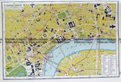
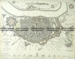
Washington D.C. street map by Rand McNally &;c.1898

Chromolithograph
66cm X 48cm
Condition A

We have many similar street maps of other cities


These may also be of interest

  • 8-177 - United States - Lake Superior J & C Walker - circa 1832 Hand coloured steel engraving 38cm X 30cm Condition A+
    Antique Maps

    Antique Map 8-177 – United States – Lake Superior J & C Walker – circa 1832 Hand coloured steel engraving 38cm X 30cm Condition A+

    $175.00
  • Antique Maps

    Antique Map 233-014 Street Map of Vienna Austria by S.D.U.K. c.1844

    $140.00
  • 8-179 - United States - North East G Philip - circa 1905 Chromolithograph 35cm X 48cm Condition A+
    Antique Maps

    Antique Map 8-179 – United States – North East G Philip – circa 1905 Chromolithograph 35cm X 48cm Condition A+

    $75.00
  • Antique Maps

    Antique Map 232-260 Boston with its Environs c.1870

    $125.00
© 2025 BRIGHTON ANTIQUE PRINTS AND MAPS. ALL RIGHTS RESERVED | Website by Blaze Online
Credit Card
Norton Safe Web Transaction
  • Home
  • Catalogue
    • Antique Maps
    • Antique Prints
    • Books & Gov’t Reports
    • Manuscript Documents
  • Recent Arrivals
  • About
  • FAQ
  • Register Interests
  • Contact Us
  • View Cart
  • Login
  • Currency
    WOOCS 2.1.5
Brought to you by WisdmLabs: WordPress Development Experts

Sending...