CURRENCY
$125.00
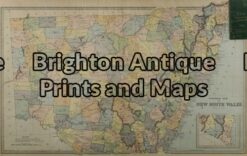
New South Wales
Picturesque Atlas – circa 1886Chromolithograph61cm X 37cmCondition A+
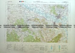
Antique Map 230-613 Albury – Wodonga area military map c.1951
Antique Map 3-805 Map of County of Cumberland by Basch circa 1872
Antique Map 232-106 Navigation Charts corrected to 1940’s
Antique Map 9-070 – New South Wales Picturesque Atlas – circa 1886 Chromolithograph 62cm X 38cm Condition A+