CURRENCY
$175.00
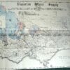
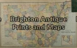
New South Wales
Picturesque Atlas – circa 1886Chromolithograph62cm X 38cmCondition A+
Antique Map 9-066 – Botany Bay / Endeavour River J Cook – circa 1774 Copperplate engraving 33cm X 13cm Condition A+
Antique Map 9-070 – New South Wales Picturesque Atlas – circa 1886 Chromolithograph 62cm X 38cm Condition A+
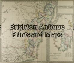
Antique Map 9-074 – New South Wales & Tasmania G Philip – circa 1859 Hand coloured steel engraving 60cm X 52cm Condition A+
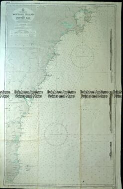
Antique Map 230-224 Navigation Chart – Montague Island to Jervis Bay