CURRENCY
Australia – showing tracks of explorers &;c.1880
Lithograph 32cm X 26cm Condition A
SOLD
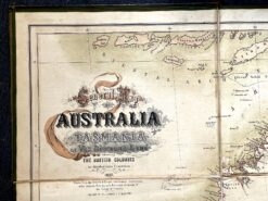
Antique map – Australia c.1857. Ref: 339-016
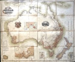
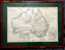
Antique Map 3-011 – Australia J Bartholomew – circa 1854 Hand coloured steel engraving 55cm X 42cm Condition A+
Antique map – Australia by Wyld c.1872 Ref: 339-031
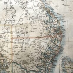
Antique Map 3-068 – New South Wales – Clarence John Sands – circa 1886 Chromolithograph 42cm X 53cm Condition A+