Skip to content
Brighton Antique Prints and MapsBrighton Antique Prints and Maps
  • CURRENCY

    WOOCS 2.1.5
  • VIEW CART
  • Catalogue
  • Home
  • Catalogue
    • Antique Maps
    • Antique Prints
    • Books & Gov’t Reports
    • Manuscript Documents
  • Recent Arrivals
  • About
  • FAQ
  • Register Interests
  • Contact Us
Antique map - China and Japan by Playfair c.1822  Ref: 339-018
Home / Antique Maps / Asia / China & Japan & Korea
  • 2-157  Tallis map of Indonesia and S. E. Asia

Antique map – China and Japan by Playfair c.1822 Ref: 339-018

  • 2-157  Tallis map of Indonesia and S. E. Asia

$180.00

Categories: Antique Maps, China & Japan & Korea
  • 2-157  Tallis map of Indonesia and S. E. Asia
Product Categories
  • Antique Maps
    • World
    • Australia & Pacific
    • Britain and Ireland
    • Europe
    • Asia
      • Asia - Continent
      • China & Japan & Korea
      • India & Ceylon
      • South East Asia
      • Middle East & Turkey
      • Holy Land
      • Siberia
      • Other
    • North America
    • South America
    • Africa
    • City Street Maps
    • Geological maps
    • Tallis
  • Antique Prints
  • Books & Gov't Reports
  • Manuscript Documents
  • Description
  • Reviews (0)

+China and Japan: Map from General Atlas by James Playfair c.1822

Copperplate engraving on high quality, heavy weight paper. The double-page map measures approx 54cm X 45cm plus wide margins. The map is in excellent condition and will lie flat when removed from the atlas.
Reviews

There are no reviews yet.

Be the first to review “Antique map – China and Japan by Playfair c.1822 Ref: 339-018” Cancel reply

You must be logged in to post a review.

These may also be of interest

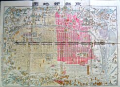
2-142 - Kyoto - Japanese street map Anon  - circa 1890 Wood block 60cm X 50cm Condition A

Antique Map 2-142 – Kyoto – Japanese street map Anon – circa 1890 Wood block 60cm X 50cm Condition A

$500.00
2-143  Kyoto street map c.1900

Antique Map 2-143 Kyoto street map c.1900

$400.00
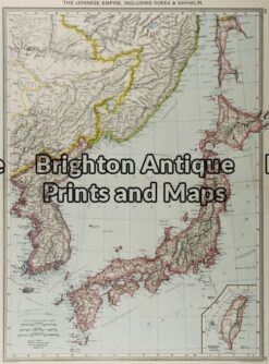
2-119 - Asia - Japan G Philip - circa 1905 Chromolithograph 35cm X 48cm Condition A+

Antique Map 2-119 – Asia – Japan G Philip – circa 1905 Chromolithograph 35cm X 48cm Condition A+

$130.00
Antique map - China - Pay-Ho or White River  c.1797 Ref# 232-863

Antique map – China – Pay-Ho or White River c.1797 Ref# 232-863

$325.00
© 2026 BRIGHTON ANTIQUE PRINTS AND MAPS. ALL RIGHTS RESERVED | Website by Blaze Online Credit Card
Visa
PayPal
Stripe
MasterCard
Cash On Delivery
  • Home
  • Catalogue
    • Antique Maps
    • Antique Prints
    • Books & Gov’t Reports
    • Manuscript Documents
  • Recent Arrivals
  • About
  • FAQ
  • Register Interests
  • Contact Us
  • View Cart

Sending...