Skip to content
Brighton Antique Prints and MapsBrighton Antique Prints and Maps
  • CURRENCY

    WOOCS 2.1.5
  • VIEW CART
  • Catalogue
  • Home
  • Catalogue
    • Antique Maps
    • Antique Prints
    • Books & Gov’t Reports
    • Manuscript Documents
  • Recent Arrivals
  • About
  • FAQ
  • Register Interests
  • Contact Us
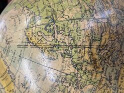
Antique Map - Globe of the world by Philip c.1930  Ref: 889-027
Antique Map - Globe of the world by Philip c.1930  Ref: 889-027 - Image 2
Antique Map - Globe of the world by Philip c.1930  Ref: 889-027 - Image 3
Antique Map - Globe of the world by Philip c.1930  Ref: 889-027 - Image 4
Antique Map - Globe of the world by Philip c.1930  Ref: 889-027
Antique Map - Globe of the world by Philip c.1930  Ref: 889-027 - Image 2
Antique Map - Globe of the world by Philip c.1930  Ref: 889-027 - Image 3
Antique Map - Globe of the world by Philip c.1930  Ref: 889-027 - Image 4
Home / Antique Maps / World / World and Hemispheres
  • 2-157  Tallis map of Indonesia and S. E. Asia

Antique Map – Globe of the world by Philip c.1930 Ref: 889-027

  • 2-157  Tallis map of Indonesia and S. E. Asia

Categories: Antique Maps, World, World and Hemispheres
  • 2-157  Tallis map of Indonesia and S. E. Asia
Product Categories
  • Antique Maps
    • World
      • World and Hemispheres
      • Antarctica & Arctic
      • Thematic
      • Celestial
    • Australia & Pacific
    • Britain and Ireland
    • Europe
    • Asia
    • North America
    • South America
    • Africa
    • City Street Maps
    • Geological maps
    • Tallis
  • Antique Prints
  • Books & Gov't Reports
  • Manuscript Documents
  • Description
  • Reviews (0)

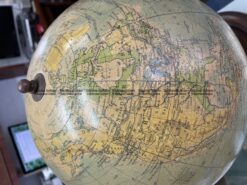
Philip’s 14 inch globe c.1930

A 14 inch terrestrial globe of the world by George Philip & Son, London. A great example of a larger than usual globe, showing geographic features of the world as it was after World War I and before the commencement of World War II.

A globe of superior quality with a plaster core, as opposed to a cardboard core. Paper gores printed by Philip were pasted to the plaster core and then varnished. Wooden base.

Postage at cost
Reviews

There are no reviews yet.

Be the first to review “Antique Map – Globe of the world by Philip c.1930 Ref: 889-027” Cancel reply

You must be logged in to post a review.

These may also be of interest

Antique Map 232-583  World - Climatological by Johnston  c.1851

Antique Map 232-583 World – Climatological by Johnston c.1851

$85.00
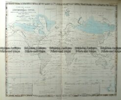
Antique Map 232-572  World - Isothermal Lines by Johnston  c.1850

Antique Map 232-572 World – Isothermal Lines by Johnston c.1850

$180.00
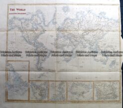
Antique Map 230-239  World on Mercator projection by S. Hall c.1850

Antique Map 230-239 World on Mercator projection by S. Hall c.1850

$150.00
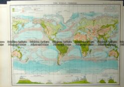
Antique Map 232-573  World - Vegetation by Bartholomew  c.1900

Antique Map 232-573 World – Vegetation by Bartholomew c.1900

$120.00
© 2026 BRIGHTON ANTIQUE PRINTS AND MAPS. ALL RIGHTS RESERVED | Website by Blaze Online Credit Card
Visa
PayPal
Stripe
MasterCard
Cash On Delivery
  • Home
  • Catalogue
    • Antique Maps
    • Antique Prints
    • Books & Gov’t Reports
    • Manuscript Documents
  • Recent Arrivals
  • About
  • FAQ
  • Register Interests
  • Contact Us
  • View Cart

Sending...