

Skip to content
Brighton Antique Prints and MapsBrighton Antique Prints and Maps
  • CURRENCY

    WOOCS 2.1.5
  • VIEW CART
  • Catalogue
  • Home
  • Catalogue
    • Antique Maps
    • Antique Prints
    • Books & Gov’t Reports
    • Manuscript Documents
  • Recent Arrivals
  • About
  • FAQ
  • Register Interests
  • Contact Us
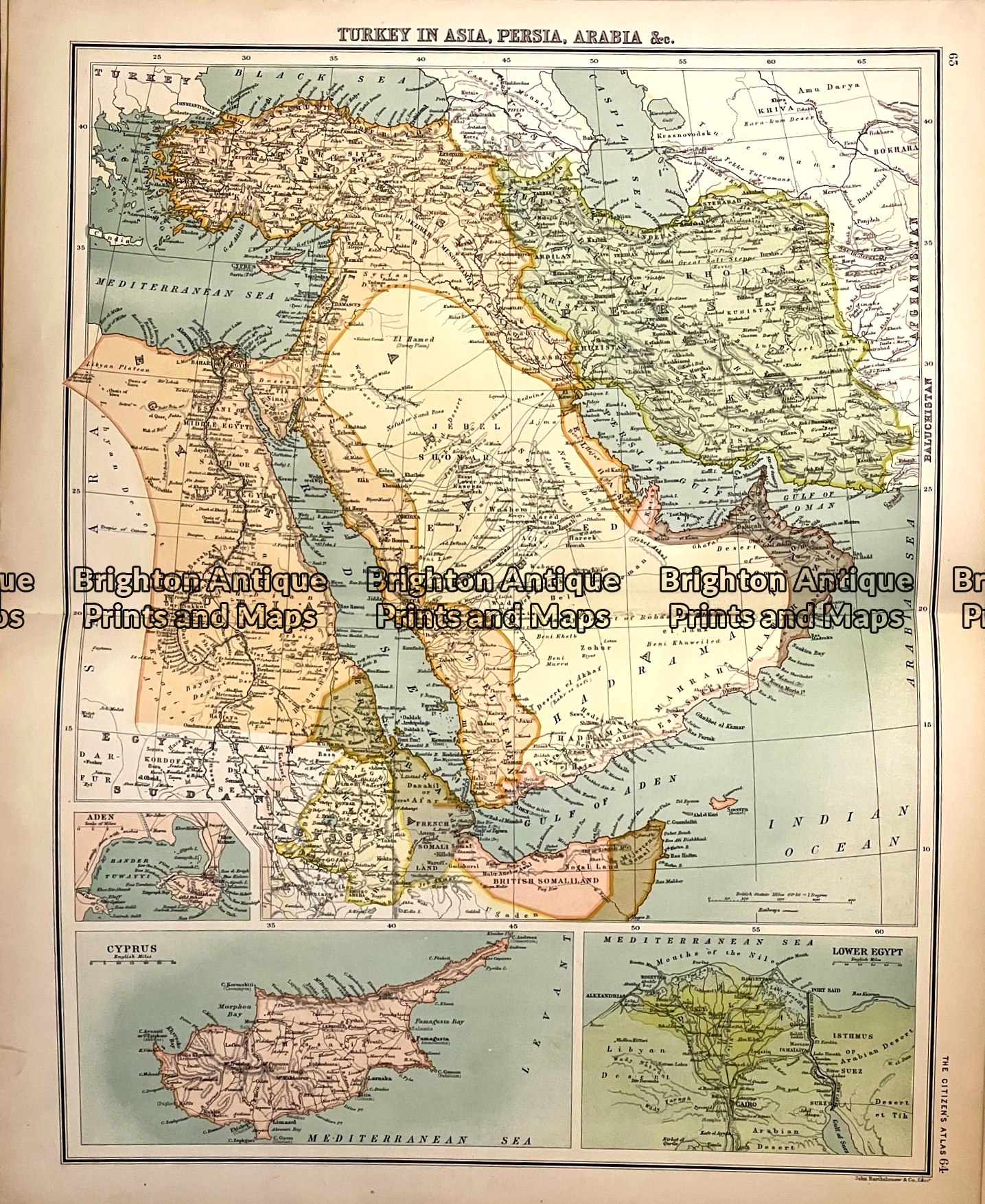
Antique map - Middle East c.1898  Ref: 888-121
Home / Antique Maps / Asia / Middle East & Turkey
  • 5-260  Turkey in Asia by Zatta  c.1785

Antique map – Middle East c.1898 Ref: 888-121

  • 5-260  Turkey in Asia by Zatta  c.1785

$60.00

Category: Middle East & Turkey
  • 5-260  Turkey in Asia by Zatta  c.1785
Product Categories
  • Antique Maps
    • World
    • Australia & Pacific
    • Britain and Ireland
    • Europe
    • Asia
      • Asia - Continent
      • China & Japan & Korea
      • India & Ceylon
      • South East Asia
      • Middle East & Turkey
      • Holy Land
      • Siberia
      • Other
    • North America
    • South America
    • Africa
    • City Street Maps
    • Geological maps
    • Tallis
  • Antique Prints
  • Books & Gov't Reports
  • Manuscript Documents
  • Description
  • Reviews (0)

Maps from the Citizen’s Atlas, published 1898.

The map was prepared by John Bartholomew & Co. It is a double-page chromolithographpprox 50cm X 40cm. The map will lie flat once it is removed from the atlas. Maps from other parts of the world are available.

Chromolithograph
Approx 50cm X 40cm
Condition A+

Reviews

There are no reviews yet.

Be the first to review “Antique map – Middle East c.1898 Ref: 888-121” Cancel reply

You must be logged in to post a review.

These may also be of interest

5-267 Palestine in Ancient Times by Wilkinson c.1830

Antique Map 5-267 Palestine in Ancient Times by Wilkinson c.1830

$140.00
Antique Map - Turkey in Asia by Teasdale c.1847  Ref: 237-121

Antique Map – Turkey in Asia by Teasdale c.1847 Ref: 237-121

$180.00
2-127 - Asia - Isfahan Persia Vander Aa - circa 1725 Copperplate engraving 35cm X 28cm Condition A+

Antique Map 2-127 – Asia – Isfahan Persia Vander Aa – circa 1725 Copperplate engraving 35cm X 28cm Condition A+

$350.00
Antique Map 5-050  Persia Empire by Teesdale  c.1847

Antique Map 5-050 Persia Empire by Teesdale c.1847

$150.00
© 2026 BRIGHTON ANTIQUE PRINTS AND MAPS. ALL RIGHTS RESERVED | Website by Blaze Online Credit Card
Visa
PayPal
Stripe
MasterCard
Cash On Delivery
  • Home
  • Catalogue
    • Antique Maps
    • Antique Prints
    • Books & Gov’t Reports
    • Manuscript Documents
  • Recent Arrivals
  • About
  • FAQ
  • Register Interests
  • Contact Us
  • View Cart

Sending...